Japanese Primrose Colony in the Taki Mountain Range

Hiking in the Taki mountain range where primrose blooms
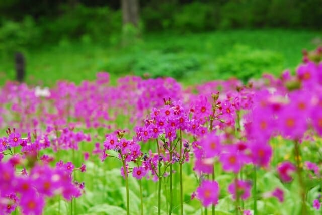
A colony of Kurinso, or Japanese primrose, ranked B in the Hyogo Prefecture Red Book, is located in the Taki Mountain Range. We will hike up Mt. Mitake for it.
【Date】Saturday, May 11, 2024
【Time】9:00a.m.-3:30p.m.
【Distance】Approx. 7 km, suitable for good walker
【Fee】Free
【Capacity】30people
Itinerary
JR Sasayamaguchi Station on the Takarazuka Line → 【FreeBus】→ Seri trailhead → Japanese Primrose Colony → Go down hill to Hiuchiwan trailhead → 【FreeBus】→ JR Sasayamaguchi Station

Remarks
Please prepare your own lunch, drinks, and other necessary items.
There are no convenience stores at the Sasayamaguchi Station, so please prepare in advance.
Please wear suitable hiking clothing.
The decision to cancel due to bad weather will be made at 3:00 p.m. the day before the event.
How to apply
Reception starts at 9:00a.m., Friday, April 28, 2023
*Registration closed due to full enrollment.
Phone: +81-79-506-1535
Hours: Monday – Friday, 9:00a.m. – 5:00p.m.
About Krinso, Japanese primrose (Primrose family)
Kurinso (Japaneseprimrose, scientific name Primulajaponica) is endemic to Japanan disatype of primrose that grows naturally in relatively cool wetlands. From the beginning of May to the beginning of June, the flowers bloom from the bottom to the top. The name ʻKurinʼ came from the flower composition which is laid on one flower axis in several tiers, which looks similar to the ʻKurinʼ, the ornament at the tip of the Buddhist pagoda.
Hyogo Prefecture has designated this colony of Japanese primrose in Taki mountain range as a ʻwetland vegetation rank Aʼ. It is because the plant communities are of national value, both in terms of quality and size.
It is estimated that 170,000 plants grow naturally on the area of about 4,300m².
Recently the number of Japanese primrose has increased in various places.
Since Japanese primrose is a repellent plant that wild animals, such as deer, do not eat, it is presumed that the increase in deer in recent years has reduced the number of other plants and increased the number of Japanese primrose. Although the existence of Japanese primrose has already been recorded in several places in this area for 70 years, it is thought that it became a large community only in recent years.
This area was the Tamba Shugen Dojo* which flourished from the Kamakura period (1192-1335) to the Muromachi period (1336-1568). In the past, it was a place of mountain worship where the sound of conch shell sandkhakhara, or priestʼs pewterstaff, echoed. The flatland which is presumed to be the ruins of Shukubo, pilgrims’ lodgings, or hermitage related to the Shugen Dojo, remains as 10 terraces, and there are also the ruins of Mt. Shin Kinpusen Daigakuji Temple nearby.
*It is one of the ancient Japanese mountain worships, which is to go through a strict training to gain enlightenment in the mountains.
The reason why the Japanese primrose natural habitat of theTaki mountain range is valuable
この投稿をInstagramで見る
・It is endangered as a species nationwide, and is ranked B as an endangered species in Hyogo Prefecture.
・The south western limit of distribution in Japanese archipelago.
・It has one of the largest areas in Japan.
・There is no horticultural species, only native species.
Notes
・Please do not enter roped-off areas.
・Please refrain from taking flowers or plants.
・You MUST NOT bring in vegetation from other places.
・Please take your own trash home.
・Please refrain from breaking branches or plucking flowers unnecessarily.
Introduction of hiking routes
この投稿をInstagramで見る
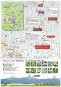
■Seri Mitake do route (Approx. 1 hour and 20 minutes to the Japanese primrose colony )
The 700 m from the trailhead of the Seri Mitake Road to the ridgeline junction with the trail from Hiuchiwan, is a relatively gentle climb. There are some shrines enshrining the Dainichi Nyorai statues along the way, which has a historical atmosphere. About 20 cars can be parked in the Seri parking lot.
■Maruyama route (Approx. 1 hour and 10 minutes to the Japanese primrose colony)
The 400m from the Maruyama trailhead to the junction with the Seri Ontake road is a slightly steep climb. The distant view of the main peak of Mitake, which you can see on the way, is wonderful. About 20 cars can be parked in the old campsite parking lot in the Maruyama area.
■Hiuchiwan route (Approx. 1 hour and 10 minutes to the Japanese primrose colony)
The 500m from the Hiuchiwan trailhead to the ridgeline junction with the trail from Seri and Maruyama is quite a steep climb, so please pace yourself. The trail is well maintained. About 50 cars can be parked in the Hiuchiwan parking lot.
Basic information
| Map | View on Google map |
Event information
| How to apply | Reception starts at 9:00 a.m. , Friday, April 15, 2024
Phone: +81-79-506-1535 |
| Parking | Please use pay parking around JR Sasayamaguchi Station |
| Organizer | Tambasasayama Tourism Association |
| Remarks | Please prepare your own lunch, water, and other necessary items. There is no convenience store at Sasayamaguchi Station, so please prepare in advance. Please wear suitable hiking clothing. |
| Fee | free |


